Anyone who has worked on a commercial project near the Merrimack River in Manchester, NH, quickly learns that surface observations don't always reveal what lies beneath. The city's glacial outwash deposits, combined with thick layers of varved clay in low-lying areas near the airport, create a subsurface environment where drilling alone can be misleading. Electrical resistivity surveys, and specifically vertical electrical sounding (VES), help us map these contrasts because the saturated silts that dominate much of Manchester's soil profile produce distinct resistivity signatures compared to the surrounding glacial till. When we run a VES array across a site in the Millyard or off South Willow Street, we're looking for that sharp drop in resistivity that signals a water-bearing layer or a pocket of soft clay, information that directly influences foundation depth and dewatering plans. This approach works particularly well in urban Manchester where heavy truck traffic from I-293 and the Everett Turnpike creates vibration constraints that rule out certain seismic methods. The result is a non-invasive, cost-effective way to build a continuous subsurface model before you commit to a single test boring.
A single VES sounding in Manchester's glacial lake deposits can replace three or four exploratory borings when it comes to mapping the clay-sand interface.
Local geotechnical context
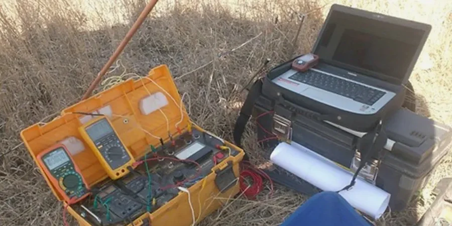
We use a 48-electrode resistivity imaging system on sites across Manchester, and the most common failure mode we observe isn't with the equipment but with the site preparation. If the electrode stakes don't achieve consistent contact resistance—something that happens frequently in the dry, sandy soils near Pine Island Park during late summer—the resulting apparent resistivity pseudosection will show artifacts that look like genuine subsurface anomalies. Our field protocol requires a contact resistance check on every electrode before the measurement sequence begins, and we carry bentonite slurry and saline solution to improve coupling in problematic spots. A misinterpreted VES curve in Manchester's layered drift geology can lead a design team to overestimate bedrock depth by 15 feet or more, pushing a project into unnecessary deep foundation costs. Worse, a missed low-resistivity zone in the saturated varved clay can result in a slope failure during excavation if the contractor wasn't expecting the abrupt strength drop that resistivity data would have flagged.
Top questions
How much does an electrical resistivity survey cost in Manchester, NH?
For most commercial and residential projects within the Manchester area, electrical resistivity surveys including VES typically range from US$660 to US$1,060. The final cost depends on the number of soundings, the array length, and whether you need 2D tomography lines in addition to 1D soundings. Sites with difficult access or extensive surface cover may require additional setup time, which we'll outline in the proposal before any fieldwork begins.
What depth can VES reach in New Hampshire glacial soils?
Effective VES investigation depth is controlled by the maximum electrode separation we can deploy on your site. In Manchester, where we often work on lots between half an acre and five acres, we routinely achieve 60 to 100 feet of penetration with a Schlumberger array. If your project needs deeper information—say for a municipal wellfield study—we can extend the array to reach 200 feet or more, provided the site geometry allows.
How does electrical resistivity compare to test borings for site characterization?
Resistivity and borings answer different questions, and the strongest investigation programs use both. A boring gives you a soil sample at one point; a VES sounding gives you a continuous electrical profile that reveals layer boundaries between borings. When we run resistivity lines across a Manchester site and tie them to a few well-placed borings, the resulting ground model is far more reliable than either method alone, especially in the city's variable glacial drift where soil types can change within 20 feet.
Can you perform resistivity surveys on paved or urban sites in Manchester?
Yes, we regularly work on paved lots and urban sites throughout Manchester, including the commercial districts along South Willow Street and the industrial parks near the airport. We use alternative electrode coupling techniques—such as base-plate electrodes with conductive gel on asphalt or drilled pilot holes through thin pavement—to maintain data quality without damaging the surface. We'll assess your specific site conditions during the walkthrough and recommend the best approach.
What deliverables do I receive after the resistivity survey?
Every project receives a signed and stamped geophysical report that includes 1D VES curves with interpreted layer models, 2D resistivity pseudosections (if performed), a site plan showing survey line locations, and a written interpretation correlating resistivity results with local geology. For projects under IBC review in Manchester, the report is formatted to integrate directly with the geotechnical investigation submitted for building permit approval.